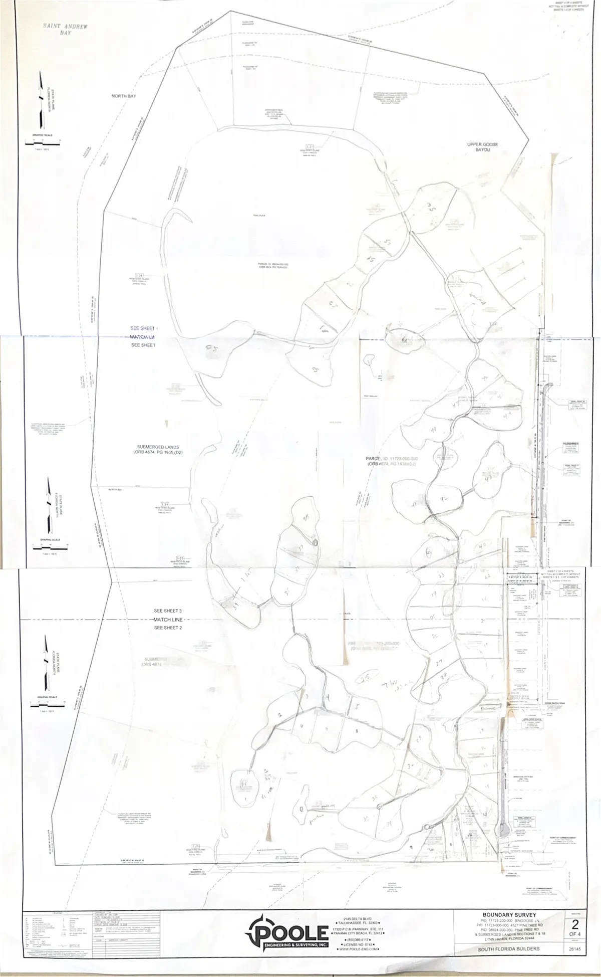
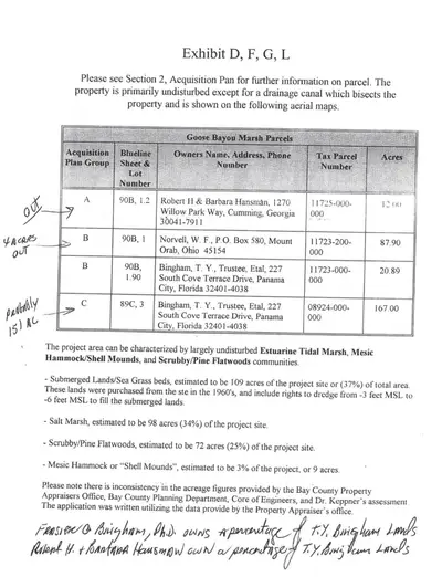
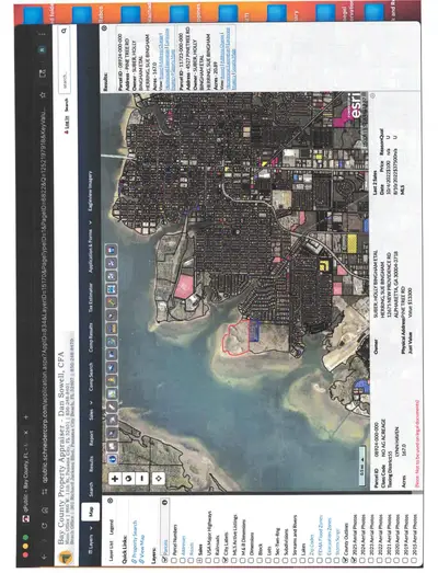
The Land
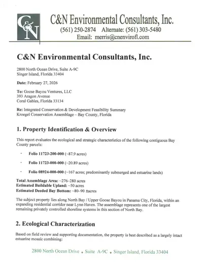
A 261-acre waterfront assemblage along North Bay and Upper Goose Bayou, near Lynn Haven. One of the largest remaining privately controlled shoreline systems in this section of North Bay.
Ecological Characterization
The site is "a largely intact estuarine mosaic" combining submerged lands and seagrass habitat, estuarine tidal marsh, scrubby pine flatwoods, and mesic hammock with shell mound features.
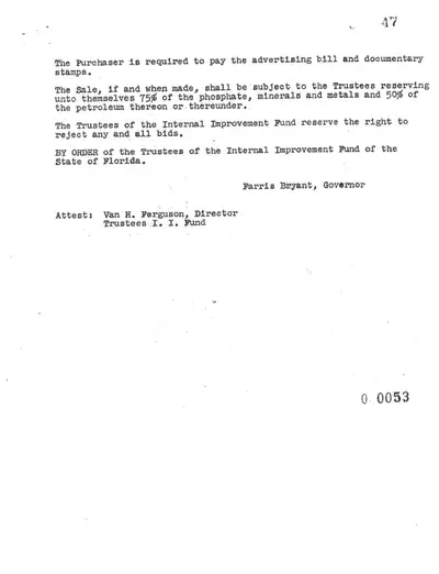
Three parcels make up the assemblage, held by the Bingham family for over 60 years, with deeded bay bottom rights dating to a 1961 State of Florida deed signed by Governor Farris Bryant.
"Large, contiguous tracts containing both submerged lands and upland transition gradients are increasingly uncommon along developed sections of the Panama City shoreline." C&N Environmental Consultants
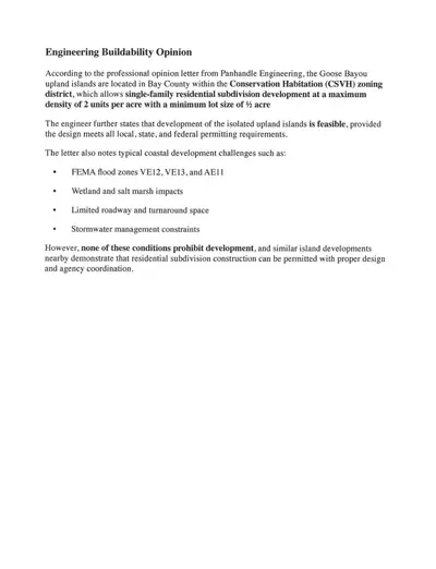
The assemblage comprises 51+ acres of buildable upland across five distinct island clusters,
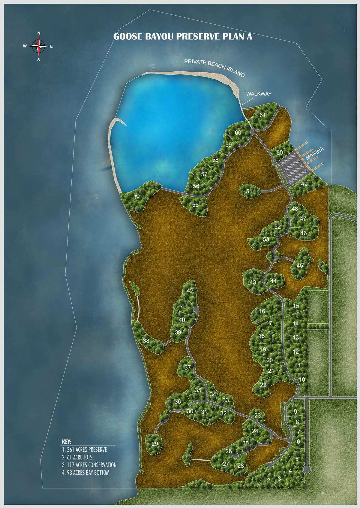
Plan A
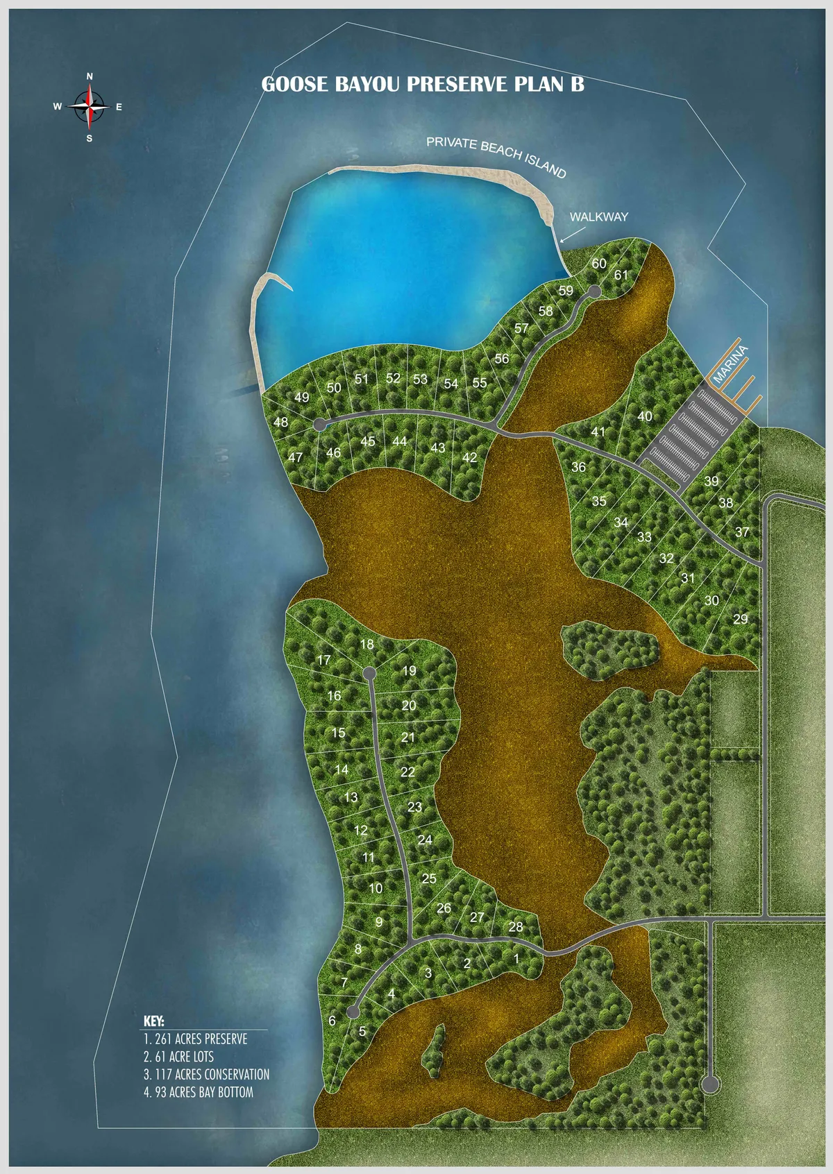
Plan B